


Foto: Canoeing among the Isletas de Granada (bron: Ronald van der Veer)
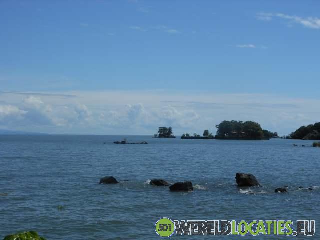
Nicaragua - I take a minibus to the lake to go canoeing among the Isletas de Granada. Off the coast of Granada lie numerous small islands, which were formed by a volcanic eruption of the Mombacho volcano. Francesco is the guide this morning. He hands me a life jacket and points to a canoe. I carefully step in and paddle against the moderate waves on the lake. Occasionally, a wave splashes over the bow of my canoe. It’s a good thing I stored my belongings in a waterproof pouch and that I’m in my swim trunks in the boat. Francesco gestures for me to follow him toward the islands. This puts me crosswise to the waves. I try carefully to keep my balance as the canoe is lifted by the swells. I reach the islands without issue. Between the islands, the water is calm and flat. As I paddle along the islands, I see various birds in the trees. Francesco points out the houses of wealthy Nicaraguans. The islands are for sale — at a high price. At a narrow passage full of aquatic plants, Francesco tells me not to worry and above all not to tip over. I paddle through the plants. With my single-person canoe, I can still maneuver fairly well, but the two-person canoe behind me is too long to make the turn through the plants. It can’t go forward or backward. Since it appears to get even narrower ahead, Francesco decides to turn back. As an alternative, I paddle around the island. I spot small restaurants on the islands. I dock briefly at the old fort. Francesco explains that this fort used to defend the city of Granada from pirates coming from the lake. From there, I paddle back over the lake to the beach. The return leg over the open lake is tougher than I expected. It’s quite a distance to paddle. As a reward, though, I get a beautiful view of the Mombacho volcano.


By car to the Masaya crater

Nicaragua - After about half an hour, Belisario turns off the main road, and the bus drives into the parking lot of Masaya National Park. The gate is still closed. It turns out the staff is in a meeting, so we have to wait. The Masaya volcano is one of the most active ...
Lava at the Telica volcano

Nicaragua - After more than an hour and a half, the Jeep stops at the base of the volcano. I see the mountain giant towering in front of me. A thick cloud of volcanic gas rises from the crater. Miguel, my guide for this volcano, hands me a flashlight. He also distributes ...
Sliding down Cerro Negro

Nicaragua - Cerro Negro is a relatively young volcano, formed in 1850. The 400-meter-high volcano is very active. In recent years, it has erupted frequently. Like the Telica volcano, Cerro Negro lies on the boundary of tectonic plates, about 35 kilometers outside ...
 The Concepcion on Isla de Ometepe

Nicaragua - At a local family’s home, a small table is set up in the yard. In the little kitchen, my breakfast is being prepared. I also meet Louis here. Louis is my guide for today, an enthusiastic 24-year-old guy. After breakfast, I'm driven to the starting point ...
The historic city of Leon

Nicaragua - In just over an hour, I arrive in León. On the way, I have a view of the Momotombo volcano. The old city of León used to lie at the foot of this volcano. When it erupted in 1523, the city was completely destroyed. The old city, León Viejo, is now on ...
The old town of Granada

Nicaragua - I’m on my way to Granada, an old colonial town located on Lake Nicaragua. Granada was founded after the Spanish invasion in 1524 and named after the Spanish city of the same name. Thanks to its favorable location 20 kilometers inland, it was an ideal ...